Plotting where future base stations need to be placed is a challenge, as often designers are not aware of objects in the environment that may affect the optimum coverage.
Researchers at Aalto University and Tampere University of Technology may have found a work-around solution by using flying drones equipped with cameras to take photographs of urban environments to get a better gauge of the surroundings.
Using both aerial photographs taken by a drone and photogrammetry software (forming 3-D objects from two or more photos), researchers were able to develop detailed 3-D models of environments, which then could be used in designing radio links.
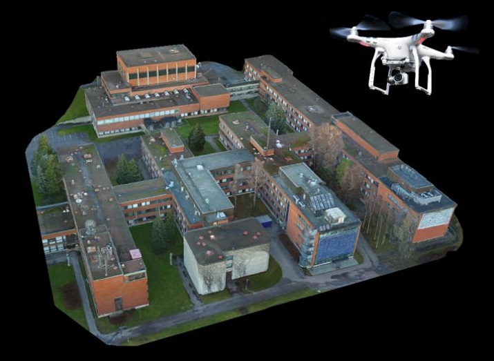 A 3-D rendering of how drones taking photos along with 3-D modeling software could help designers decide the ideal location for base stations. Source: Aalto University The result was that 3-D models were beneficial for network planning at millimeter-wave frequencies, and the design process was one that was much more cost-efficient than traditional network base station plotting.
“With the technique used by us, the resulting 3-D model of the environment is much more detailed, and the technique also makes it possible to carry out the design process in a more cost-efficient way,” says Vasilii Semkin, head researcher of the project. “It is then easier for designers to decide which objects in the environment need to be taken into account, and where the base stations should be placed to get the optimum coverage.”
The researchers say that while they are working on using this technique for current technology, it could also be possible to use it to design future 5G wireless connections.
