
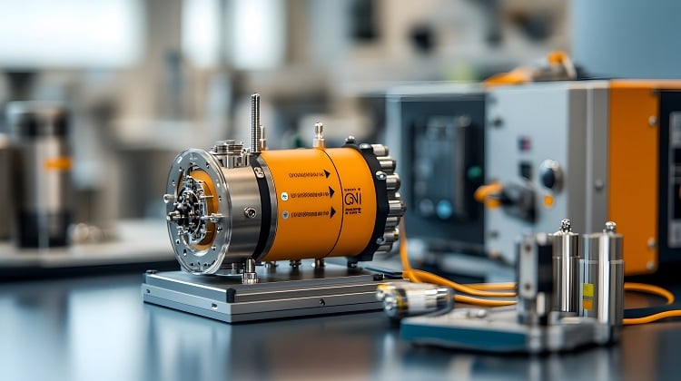
Quantum magnetometers detecting minuscule variations in the strength of Earth’s magnetic field are being tested as an iron-clad navigation back-up when GPS is jammed or spoofed.
Since early 2026, several Ukrainian long-range unmanned aerial vehicles heading for Russia have been shot down or crashed in the Baltic states of Estonia, Latvia and Lithuania. The drones, carrying explosives to strike Russian infrastructure, were not supposed to be in the Baltics. Ukrainian air forces didn’t send them there and had, in fact, no clue that the drones entered NATO airspace.
The reason for these mysterious excursions was the spoofing of the global navigation satellite system (GNSS) signal that these drones rely on to find their target. GNSS systems, such as the American GPS or European Galileo, orbit more than 12,000 miles above Earth’s surface. By the time their signal reaches the ground receivers, it’s so weak it can be easily overridden by transmitters on Earth.
Both Russia and Ukraine use GNSS jammers along the frontline in Eastern Ukraine to prevent enemy reconnaissance and kamikaze drones from finding their targets. But Russia is also suppressing the signal with noise of the same frequency (jamming) and overriding the original signal with a fake one carrying incorrect coordinates (spoofing) GNSS signal outside of Ukraine to wage its hybrid war on Europe. Across the Baltic Sea and all the way south to the Black Sea, airliners and ship captains must have relearned to navigate the old way, without GNSS. In the Middle East, the situation is quite similar.
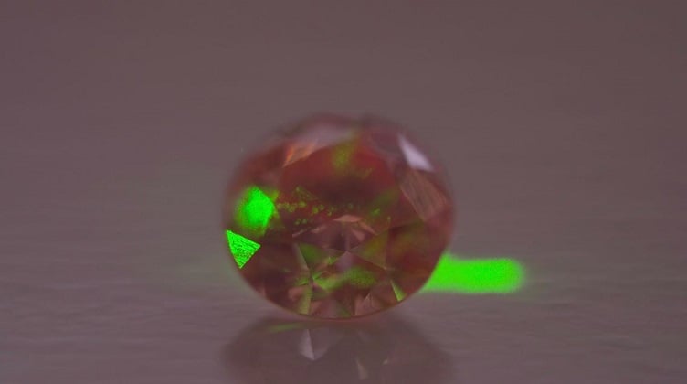 A photo of SBQuantum’s diamond quantum magnetometer that potentially unlocks new sensing applications across Earth and beyond. Source: SBQuantum
Unjammable magnetic field
A new tool, based on the responses of the quantum states of atoms to minuscule variations in Earth’s magnetic field, will soon be available to help pilots, ship captains and drone operators to spot interference sooner.
The navigation technique relies on the detection of electron spins — the rotation of the elementary particles inside atoms — and has been tested with promising results in air, on sea and land.
“The spin is kind of the smallest magnet you can think of,” David Roy-Guay, the chief technology officer at Canadian firm SBQuantum, told GlobalSpec. “It’s sensitive to Earth’s magnetic field and from that you can infer the vector of the magnetic field.”
SBQuantum’s magnetometers use free electrons inside a tetragonal diamond crystal that spin in place of a removed carbon atom. The palm-sized detector is attached to a compact laser source that probes the states of the electrons.
“We’re sending a green laser on the diamond and that makes the diamond glow red,” Roy-Guay said. “The intensity of the red light will be modulated by the intensity of the magnetic field. So, we collect the red light and translate the information into a magnetic field reading.”
The device’s measurements are compared against the magnetic map of the planet, allowing users to determine their location with the precision of around 100 meters. That is, undoubtedly, not as precise as the centimeter-level precision that GNSS offers, but it’s more than enough to alert pilots or drone operators if their GNSS signal has been tampered with.
“Atoms are the same everywhere, that’s the main advantage of this technology,” Michael Hush, the chief scientist at Australian Q-CTRL, which develops a different kind of quantum magnetometers based on rubidium atoms, told GlobalSpec. “So, you can make sensors which are reliable under completely different conditions. You don’t need to worry about calibration, which could be a challenge with classical sensors.”
Moreover, added Roy-Guay, the system can hardly be spoofed as any interference would only be short-lived.
“You can throw some magnets on the ground but the magnetic field decays very quickly,” he said. “So, it’s very difficult to spoof the magnetic signal.”
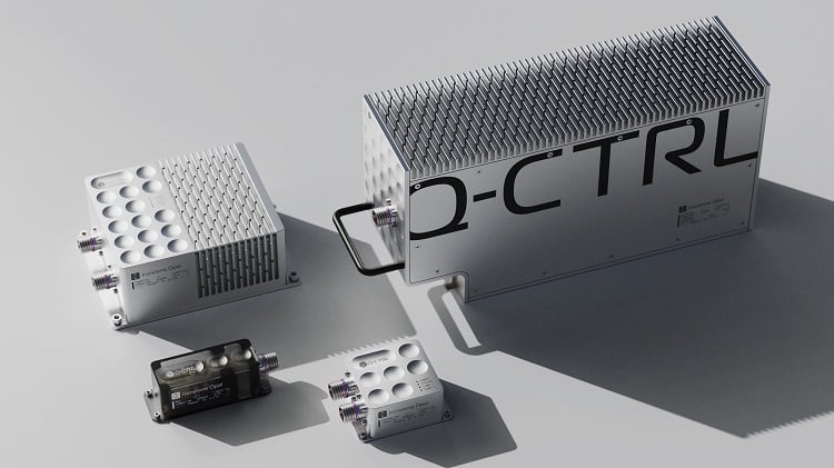 Some of the quantum magnetometers under development from Q-CTRL. Source: Q-CTRL
From compass to electron spins
In its crudest form, magnetic navigation has been used for centuries. The good old compass has been helping travellers to find their bearings for nearly a thousand years. But while the compass simply points to the magnetic north, the quantum magnetometer measures the tiniest variations of the strength of Earth’s magnetic field, which are caused by the chemical composition of surface and underground rocks and soils. Specialist magnetometers onboard satellites and survey planes have been used for decades to create accurate magnetic anomaly maps of the planet. As technology improved, these maps have become so detailed that they can now be used for precise navigation.
Quantum magnetometers, such as those developed by Q-CTRL and SBQuantum, can detect magnetic variations as small as 1 nano-Tesla. Tesla is a unit that measures the changing strength and density of the magnetic field. The Earth’s magnetic field has an average strength of 0.00,005 Tesla. The variations used for navigation are much smaller — in the range of one billionth of a Tesla.
Roy-Guay said that SBQuantum’s sensors can spot even unexpected magnetic field ripples triggered by submarines passing under the surface of the ocean or variations caused by military technology hidden in underground tunnels, under snow or obscured by smoke.
60+ years of research
Scientists have studied quantum magnetometry since the 1960s, but the earliest devices required large superconducting magnets cooled to extremely low temperatures. These magnetometers are today being used in medical imaging to reveal the magnetic activity in human tissues and scan for damage. But they could hardly be turned into portable systems that could fly on drones or fit into the cockpit of a commercial airliner.
First quantum-based magnetometers using spins of sub-atomic particles to measure the variations in extremely weak magnetic fields were developed in the 1960s. Such devices could operate at room temperature, making them suitable for a wider range of use cases. Still, it took decades to take the technology from lab to the real world.
Hush said that when Q-CTRL began its work in earnest five years ago, the magnetometer sensor head “was the size of a basketball and the control electronics with the laser system were about the size of a server rack.” Today, the company‘s devices have a sensor head the size of a 50-cent coin and a control system the size of a half a breadloaf.
Q-CTRL and SBQuantum are two of a handful of companies leading the emerging quantum magnetometry navigation field. While SBQuantum uses solid state diamond crystals with engineered defects to create the magnetometers, Q-CTRL relies on rubidium atom vapor trapped inside a tiny glass cell. Q-CTRL’s Ironstone Opal quantum magnetometer uses polarized laser light to synchronize the electron spins inside the atoms. The electron spins respond to the magnetic field changes by deviating from their original direction.
Trials underway
Both companies have conducted a range of trials to demonstrate the performance of their devices in real world scenarios.
Q-CTRL successfully tested the Ironstone Opal magnetometer on a Cessna plane, on a helicopter and in cars on land. The company recently opened a new testing facility in Huntsville, Alabama, to test the device on drones. Q-CTRL has also developed a more complex device — a quantum gravimeter — that measures the effects of gravity variations on a spray of falling atoms. Just like the magnetic field, the Earth’s gravitational field, too, is not uniform, and the subtle differences in its strength could be used for navigation, especially on sea where the magnetic field can be distorted, said Hush.
SBQuantum, too, has conducted successful ship, drone and airplane trials, and hopes to begin trials with unmanned submarines and aerial drones in the future
Jamming and spoofing are not the only source of GPS disruptions. During intense solar storms, GPS signals could become inaccurate for days. Moreover, the satellite signal doesn’t reach underground or penetrate underwater and inside buildings. Other technologies are being looked at to provide a more resilient GPS backup including satellites in lower orbits that transmit a stronger, less vulnerable signal. Radio frequency transmissions from Earth-based sources (the E-Loran system) and 5G cell towers, too, can be used to distribute the positioning, navigation and timing signal to users in case of GPS disruption.
