
Scientists at the Fraunhofer Institute for Communication, Information Processing and Ergonomics (FKIE) in Germany have created artificial intelligence (AI)-powered automated drones and robots that can detect radioactive waste in hazardous environments where human access is unsafe or impossible.
To accomplish this, the team is combining uncrewed aerial systems (UAS) and uncrewed ground vehicles (UGW) with advanced sensor fusion, automation and probabilistic search algorithms with the intention of reducing the time it takes to locate radioactive, chemical or biological hazards during emergencies.
 Source: Fraunhofer FKIE
According to the team, the technology can localize radioactive sources to within a few feet. The technology’s detection process is automated and conducted in an exploration phase and a search phase. During the exploration phase, the drone follows a predefined flight pattern and measures background radiation. When a system detects an anomaly, it will switch into a targeted search mode and dynamically adjust its flight path according to real-time sensor input and previously collected data.
“Once the pilot launches the drone, it initially follows a fixed flight pattern,” the team said. “As soon as sufficient sensor data is available, the system switches to adaptive search mode, using the accumulated information to independently calculate where the source might be.”
The system uses stochastic algorithms, which estimate the probability of the radioactive source’s location. While the drone collects data, it simultaneously creates waypoints autonomously until it intersects on the most likely location.
Further, the technology maps radiation intensity in real time with the help of spatial heat maps. It also includes probability maps that highlight the locations with the greatest likelihood of containing hazardous material.
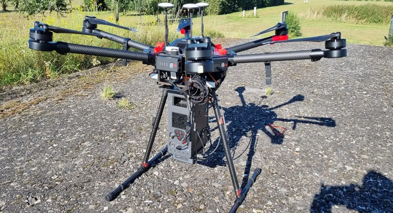
The drone carries a gamma detector and other detection sensors, supported by electro-optical and infrared cameras, onboard Intel NUC data processing, an IMU for navigation, and an LTE module that allows for real-time ground monitoring.
Using onboard cameras, the drones can detect objects such as people, buildings and vehicles and these objects can be displayed on a map with georeferencing. Meanwhile, the IMU records the location and movement of the drone in 3D.
Simultaneously, the scientists are also developing uncrewed ground robots to function in environments considered too dangerous even after aerial reconnaissance. They incorporate CBRNE sensors, autonomous navigation and geodata processing to confirm threats, map hazardous zones and support recovery operations.
One iteration features a ‘click and grasp’ system that enables operators to select objects directly from a live video feed and, using its robotic arm, to autonomously pick up, analyze and secure radioactive material.
