GeoCue has introduced a street view navigation lidar device that allows industrial users to take precise distance measurements directly inside photography tools.
The navigation device could be used for surveyors, public safety teams, facility managers and other professionals that need street view navigation for:
- Inspecting buildings
- Navigating factory floors
- Retracing pathways
- Plotting zoning patterns
Called LP360, the street view navigation lidar allows users to interact with the data in a smart way by virtually walking through a scan and then moving forward and backward between capture points. It also allows rotating through a scene from any angle.
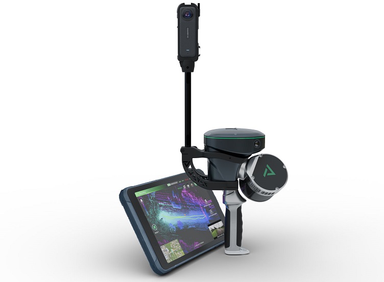
When paired with GeoCue’s TrueView GO 360 photo kit, it integrates an Insta360 camera into a handheld lidar for a street view experience for consumers, the company said.
GeoCue said this allows these professionals to accelerate validation, improve communication and streamline workflows without any third-party viewer required.
“We continue to adapt and update our products to meet the needs of the surveying and mapping community,” said Frank Darmayan, CEO of GeoCue. “The TrueView GO 360 Photo Kit expands the capabilities and deliverables of our handheld mapping system, while LP360 lets you explore your point cloud data and imagery in more powerful ways than ever before.”
The LP360 street view navigation and photo kit allow users to walk through project data without being virtually there as well as confirm measurements on the fly and visualize details from a ground perspective.
GeoCue is also introducing two software add-ons like 3D mesh modeling and Gaussian Splatting. The 3D mesh models allow industries like engineering and construction to become a part of surveying, CAD and BIM workflows. The 3D Gaussian Splatting that transforms raw data into visual experiences, could allow the lidar to be used for virtual reality, gaming and digital storytelling.
