A sprawling early medieval fortress from the 5th to the 7th century A.D. has been uncovered by researchers from Spain’s University of Santiago de Compostela using lidar.
Lidar is a method of remote sensing using light in the form of pulsed lasers to measure range and map environments. The differences in laser return times and measuring the wavelengths can be used to create a 3D digital map of the landscape to remove obscuring features such as trees or rocks.
The technology is commonly used in automotive safety today and will be used in autonomous driving in the future. However, lidar is also being used for indoor and outdoor mapping, accident prevention, smart city development, people counting and more.
This isn’t the first-time researchers have used lidar on an archaeological site. Last year, the German Archaeological Institute used lidar attached to a helicopter to uncover a lost city in the Amazon.
The medieval fortress of Castro Valente was previously thought to be an Iron Age fortified enclosure on a 1,300 ft high hillock.
However, the lidar survey conducted by University of Santiago de Compostela revealed the site is much larger, covering 30 acres surrounded by a defensive wall spanning three-quarters of a mile, according to a report from Heritage Daily.
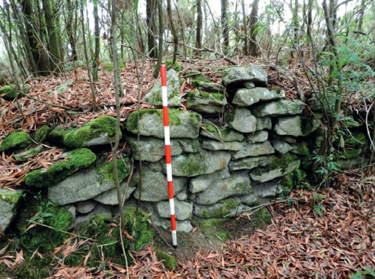
The lidar survey found the walls were built using double-leaf masonry construction with a thickness varying between 8 ft to 14 ft. It also includes a series of 30 towers in a similar style to the 3rd century Roman walls that defended the town of Lugo, Spain.
Several of the structures were found to be made from perishable materials and stone, revealing brick and tiles from the Roman period and small fragments of red-paste ceramics during excavations.
“The results have allowed us to document the construction technique of the defensive system and locate a possible wall-like structure belonging to an intramural building,” said the report on the lidar survey from University of Santiago de Compostela researchers. “In the survey carried out in one of the [towers], a large number of fragments of [tiles] was recorded, which makes us think that this tower could have been covered by these pieces of Roman tradition.”
The next steps will be to determine the true nature of the site before an installation of four wind turbines, six electrical towers and an electrical substation are built on the archeological site.
The full research can be found at the University of Navarra.
