The main application for lidar from a pure volume level will be the automotive market but the technology is finding itself being ported to other industries rapidly. Continuing this trend is Outsight, which launched its first real-time lidar sensor for the forestry industry.
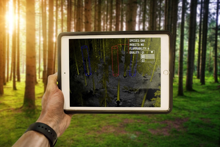
The lidar is a mapping solution capable of generating a comprehensive 3D map of a forest in real-time, eliminating the need for a human or machine operator to traverse the plot.
The lidar automatically determines the exact position and characteristics of trees and operators on-site can digitally tag each tree with supplemental information such as species or the presence of insects.
Other lidar has already been used by forestry researchers such as the Université du Québec en Outaouais in Gatineau, Canada, which is using the technology to assist in forest monitoring research. The university said the lidar was able to complete forest surveys three times faster than traditional methods and was able to maintain detailed inventory of the plot with notes that were automatically tagged to each tree.
Additionally, Outsight’s lidar was used by Insight Robotics, a leader in the forestry risk management sector. The ground-based lidar tool was used to supplement Insight Robotics' aerial survey solution to give accurate survey data to better manage forests and plantations.
