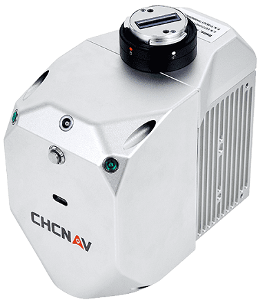
CHC Navigation has released the AlphaAir 450 lidar system, a compact all-in-one sensor featuring inertial measurement unit (IMU), global navigation satellite system (GNSS), 3D scanner and camera.
 The lidar can be used for power line inspection, topographic mapping, emergency response, agricultural and forestry surveys and more. The device, which is designed to be deployed rapidly in the field, can be used for power line inspection, topographic mapping, emergency response, agricultural and forestry surveys and more.
The unit is lightweight, weighing only 1 kg, to be mounted on unmanned aerial systems (UAS) and can operate at extreme temperatures down to -20° C and up to 50° C in any field environment.
By combining the industrial grade GNSS with a high precision IMU, the AlphaAir 450 can achieve accuracy of 5 cm vertical and 10 cm horizontal for small survey areas.
