
Researchers from Texas A&M have created a tool that uses the architecture of city drainage systems and readings from flood gauges to predict floods in extreme weather events. The tool can forecast the flow of water in almost real-time, enabling timelier emergency response and planning.
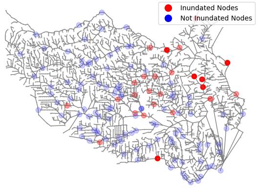 Mostafavi's probability-based model in action. Blue filled circles denote nodes that have a small probability of flooding whereas red filled circles show nodes that will have a higher probability of inundation. The darker the red color, the higher probability of flooding. Source: Texas A&M University College of Engineering
Physics-based models have been used to predict where water may collect or overflow and cause flooding. These models capture physical features on the surface and determine how urban landscapes affect the flow of water. While these tools are effective, they don’t perform as well during incidents of torrential rainfall and only offer one perspective on how floods spread.
Drainage channels are an elaborate network of intertwined channels that meet at nodes. The flooding in one channel can directly or indirectly affect other channels and cause floods to spread.
The team created a probability-based model that was fed water level readings on flood gauges. The readings were for different time points during two major flooding events in Texas. The floods were Hurricane Harvey and the Memorial Day Flood of 2015 in Houston. After training, the team tested the model by checking if it could predict flood patterns that were observed. The model achieved 85 percent accuracy in predicting how a flood moves through a drainage system during the Memorial Day flood. The results suggest that it will be able to predict how new floods propagate through a city’s drainage networks.
The tool could help emergency responders take preemptive steps towards evacuations before the flood hits.
The team admits that the tool isn’t perfect. Its performance could be compromised if the sensors on the gauges fail. But if this tool worked with the existing physics tool, it could create the ultimate flood accuracy tool. Traditional and data-driven models complement each other.
A paper on this technology was published in Computer-Aided Civil and Infrastructure Engineering.
