Autonomous diving robots are becoming a major tool for scientists to carry out deep-sea measurements and gathering information with high-resolution images. This much data is great for research, but can take a long time to parse. Researchers have now developed an AI-based program that saves time and gets results faster.
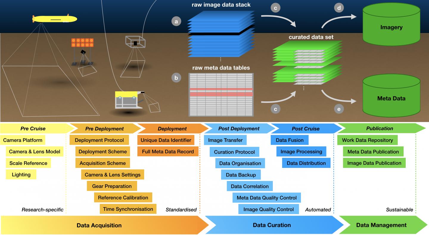 This is a schematic overview of the workflow for the analysis of image data from data acquisition through curation to data management. Source: Timm Schoening/GEOMAR
"Over the past three years, we have developed a standardized workflow that makes it possible to scientifically evaluate large amounts of image data systematically and sustainably," explains Dr. Timm Schoening from the Deep Sea Monitoring working group headed by Dr. Jens Greinert at GEOMAR.
The diving robots have an integrated camera incorporating the AI program. The robots were used to study the ecosystem around magnesium nodules in the Pacific Ocean.
The AI method represents a first for a deep-sea study workflow. The data collecting procedure has three steps: data acquisition, data curation and data management.
"For data processing, it is essential to link the camera's image data with the diving robot's metadata," says Schoening. "All this information has to be linked to the respective image because it provides important information for subsequent evaluation.”
The AUV ABYSS collected 500,000 images of the seafloor over around 30 dives. The automated data system then went through the gathered photos and deleted the unusable material.
"Until then, however, a large number of time-consuming steps had been necessary," says Schoening. "Now the method can be transferred to any project, even with other AUVs or camera systems."
The AI algorithm used to evaluate the images is called CoMoNoD. The algorithm automatically detects if there are nodules in the photo and gathers data about the size and placement of the nodules. The successful images were then gathered together to create a large map of the seafloor.
The paper on the new research was published in Scientific Data.
