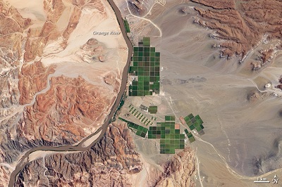
 Image Credit: NASASpace-borne remotely sensed data offers users a distinct advantage over traditional surveys when estimating crop yield over large spatial fields. It can be used to qualitatively depict yield potential with only a limited amount of field data. To accomplish this, physical measurements of above-ground wet biomass (AWB) are correlated with what is referred to as vegetative indices and extrapolated over large spatial fields to estimate yield potential.
Vegetative indices (VI) are based off surface reflectance data in the red and near-infrared (NIR) wavelength regions. Chlorophyll strongly absorbs red wavelengths and reflects NIR wavelengths, while ratios of surface reflected data in the visible red to NIR regions depict the amount of vegetation present.
The normalized difference vegetation index (NDVI) is a simple index that has been widely used to analyze vegetation and is directly related to the photosynthetic capacity. It is based off of multispectral broadband (MSBB) data and is defined as the difference in surface reflectance between the NIR and red spectral bands over their sum.
NDVI has been very useful in quantifying if and how much vegetation is present, although it is rather limited when delineating different vegetative species. Neighboring vegetation is not easily distinguished and can give rise to error when estimating crop yield.
Hyperspectral imaging provides increased accuracy over broadband NDVI measurements when evaluating yield potential by use of advanced narrow band indices that better characterize vegetative species, even though spatial resolution is compromised.
Resolution
Types of satellite imagery are compared by their spatial, spectral, temporal, and radiometric resolution. The spatial resolution refers to the level detail or smallest detectable object in an image. The spectral resolution is the range of wavelengths in each spectral band captured by the imaging sensor. Temporal resolution is the time period between subsequent images of a given geographic location and radiometric resolution specifies brightness in an image and is indicative of signal strength.
In satellite imagery, there are trade-offs between respective resolutions. There needs to be a degree of radiometric resolution in order to differentiate objects by reflected spectral band intensity. If spectral resolution is increased, spatial resolution must be reduced, as there are fewer photons to be collected over a smaller bandwidth and increasing the spatial field corrects for the inadequate signal strength.
Hyperspectral Imaging
Hyperspectral Imaging includes hundreds of hyperspectral narrow bands (HNBs) and, specifically, NASA’s Earth Observing-1 (EO-1) satellite acquires 220 of these HNBs using a Hyperion imaging spectrometer. The imaging sensor offers continuous spectral coverage from 0.4 to 2.5 µm with a spectral resolution of 10nm and a spatial resolution of 30m.
30m is coarse in comparison to high spatial resolution MSBB satellites, but the 220 HNBs allow for spectral detail. Having this level of detail across a wide range of the electromagnetic spectrum delivers powerful insight and, with the 220 data points, the spectral signature of a given object can be easily identified.
Users are even able to delineate different types of vegetative species by employing advanced two-band vegetation indices (TBVIs) and multiband vegetation indices (MBVIs). These advanced VI’s are custom built to identify a given crop by its spectral signature as there is either a dramatic drop off in surface reflectance or unique peaks and troughs in the spectral signature that differs for each crop.
The best HNB vegetation indices for rice crops involve spectral bands centered on 549 and 752 nm, a somewhat wide separation in HNBs as the absorbed and reflected wavelengths lack a dramatic cut-off frequency. On the other hand, cotton crops are best distinguished by a narrow separation in spectral bands centered on 722 and 732 nm wavelengths as the dramatic cut-off frequency for this crop is well pronounced between those data points.
Hyperspectral sensors offer a level of spectral detail that outweighs the high spatial resolution of advanced space-borne multispectral broadband (MSBB) sensors. Use of distinct HNBs improves crop biomass estimation over large spatial fields and, while yield potential has been difficult to estimate for some crops, hyperspectral imaging provides repeatable results with improved accuracy and can help minimize the need for field surveys for these applications.
Resources:
