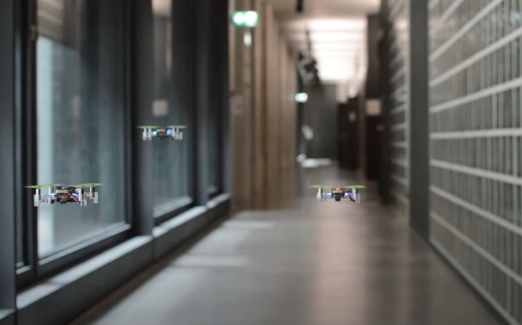
Swarms of robots have been growing in importance due to their flexibility in completing various tasks that are difficult for a single robot or an unmanned aerial vehicle (UAV). Everything from spraying a field with pesticides to forming giant light shows in the sky are easier in groups.
However, their implementation is still limited in dynamic environments due to difficulty navigating around and communicating with each other. Theoretically, having multiple communication network nodes with their own positional sensors would make it easier for members of a swarm to understand and move around that space.
However, implementing the technical features of such a network remains out of reach, due to a lack of a shared framework that allows drones to easily communicate and coordinate with each other. To help address this, researchers from the Shangdong University of Science at Technology summarized over 150 technical papers on "collaborative positioning" for swarms — and here’s what they found.
Swarming sensors
Swarms have a wide variety of use cases and can be made up of many different types of system. A single "swarm" network could contain satellites, underwater autonomous vehicles, ground-based vehicles and even handheld networking gear. Understanding precisely where each member of a swarm is remains a difficult challenge, and researching potential solutions to that challenge focuses on the concept of collaborative positioning.
Several technical factors contribute to that challenge, but two of the most difficult to overcome are lack of precise positioning and slow communications speeds. Typical drones will use standard GPS chipsets for their positioning. While they are useful for general positioning, they lack the centimeter-level precision that would be necessary to coordinate exact positions with other drones in the swarm. If, for example, they are attempting to search an area together, there could be a few meters gap in coverage area due to lack of precise positioning.
To alleviate this weakness, the paper looked at different types of sensors that could fuse their data together with one another to create a more wholistic picture of where a drone is located. The different types of sensors can broadly be grouped into three categories — visual, light detection and ranging (lidar) and wireless sensors. Visual is the typical camera system common today on everything from drones to satellites to cell phones. Data these sensors collect help the swarm members understand their immediate surroundings, though they aren't particularly useful in some cases, such as underwater, as the opacity of water limits the transmission of light at wavelengths these sensors can detect.
Lidar suffers from the same problem underwater as the infrared wavelengths it uses are also commonly absorbed by water — except for bathymetric lidar systems that are designed specifically for use in underwater environments. However, the standard infrared lidar systems are very commonly used in applications like autonomous driving and UAV flight. A positioning system is best considered that allows members of the swarm to avoid objects in their surroundings. In some cases, they can include other members of the swarm itself. However, some swarm members, such as satellites, would not benefit as much from lidar data given their extreme distance from anything potentially hazardous.
Wireless sensors are a more nuanced way of measuring distances to different points — especially other members of the swarm itself. Antenna power output and received signal strength can be used as a proxy for distance if a decent model of the media between the two sensors is known and if the two nodes know they are talking to one another. The math for determining distances to several sensors gets complicated quickly, but using this to confirm the distance measurements from other lidar sensors allows individual swarm nodes to complete their overall positioning puzzle.
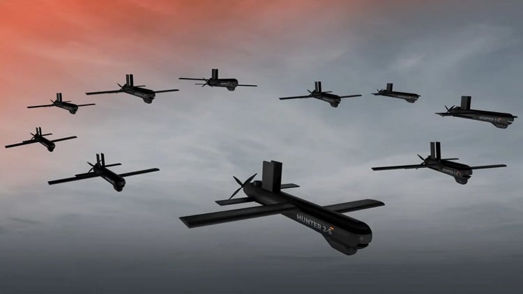 The military is looking into how connected tactical swarm drones could be used to share information with one another to track and maintain their relative positions, and to effectively engage targets. Source: Halcon AE
Multi-node networking
To really complete that puzzle, though, each member of the swarm must share information with all the others. Swarms use two main network topologies, centralized and decentralized networks, which are also common in other wireless networks.
In a centralized network, one main “Agent” serves as a focal point for all other nodes on the network. In essence, all the nodes must talk through that one individual central point. While this is great for scalability, as an "agent," this can be a beefy piece of hardware with many connections made to it simultaneously, it lacks reliability, as knocking out the agent brings the whole network down. In military applications, in particular, that is a non-starter.
Therefore, many swarm designers are adopting a decentralized structure, which is similar to a "meshing" wireless network, where each node on the network can talk to any other node and can also talk to a central agent if necessary, whether that's directly themselves or through another node that's used as a pass-through. In these systems, the information-theory algorithms required to calculate the optimal network structure would strain the computation resources available to some of the simpler nodes on the network, as sharing data-intensive structures like lidar or camera images can quickly overwhelm long-range wireless communications protocols.
Network bottlenecks are only one challenge facing the further design of swarm positioning systems. Others include computational constraints for onboard processing and how to blend maps and images from disparate vantage points into one coherent system that the swarm can navigate through.
In addition to bottlenecks, networks can face stability challenges as nodes in the swarm move about their environment. Limited work has been done on maximizing the total amount of information conveyed amongst swarm members or on ensuring network stability in a dynamic environment.
In more traditional networking settings, brute computational force could try to plug the gap of network unreliability. However, the computational burden of methods like error-correcting codes and other algorithmically complex communication reliability solutions would be additional constraints on some swarm members' already limited computational power — especially those who rely solely on batteries and would have to lug around heavier computational equipment. That computational limitation also applies to algorithms like deep learning, which could benefit the nodes as they attempt to recognize objects in their visual or lidar images. However, improvements are on the way in deep learning methodologies that could lighten that burden a bit.
But one of the most complex mathematical challenges remains to make sense of the swarm's surroundings in the form of a collective "map." Developing a cohesive, consistent and dynamic map of the surroundings of a network of movable nodes is one of the most complex mathematical challenges facing the collaborative positioning crowd. To build a dynamic map, each node must collect their own positional, visual and lidar data and either share it with a base station or exchange it with another member of the swarm.
In the case of a base station, it would then have to use a series of information theory algorithms to try to piece together similar objects in each set of sensor data — for example, two drones could see the same light post from different angles. The base station would receive that data and must be able to calculate that it is, in fact, the same light post. It would then have to send commands back out to the nodes of the swarm that considers the position of its fellow swarm members. And this data would have to be updated every few seconds as the swarm members move about the shared space.
Inter-node exchange is even more resource constrained as every individual node on the network would be responsible for synthesizing its own position amongst its peers. Similar computational resource constraints make calculating and sharing that information difficult, though techniques like sparse image sampling or data compression could reach the load a bit.
Ultimately, swarm designers, and the nodes that make up the swarms themselves, could benefit from a standardized "framework" for sharing all the different information between nodes that can then be processed coherently. However, as the authors point out, such a framework does not yet exist.
The future of swarms
That sounds like an opportunity to improve in one of the most important areas regarding autonomous swarms. If we are one day to have a truly autonomous mobility future, with flying cars, delivery drones and dramatically decreased transportation casualties, collaborative positioning will be a critical tool in that environment.
Many long-term capabilities of swarms can only be truly unlocked once they have shared collaborative positioning systems. These range from search-and-rescue missions where thousands of tiny robots’ fan out to comprehensively search an area to collaboratively lifting heavy objects that no single node would be able to do by itself.
Humans work best when they are coordinating, and the same can be said for drones and robots. Unlocking a swarm’s ability to see the world from literally multiple points of view and coordinating their next actions through a shared wireless communication framework will enable a level of coordination that no human team would ever be able to match.
About the author
Andy Tomaswick is an engineer and freelance writer who is passionate about education, space exploration and improving the world through technology. When he's not engineering or writing, he spends time with his family or runs in circles to stay in shape.
