
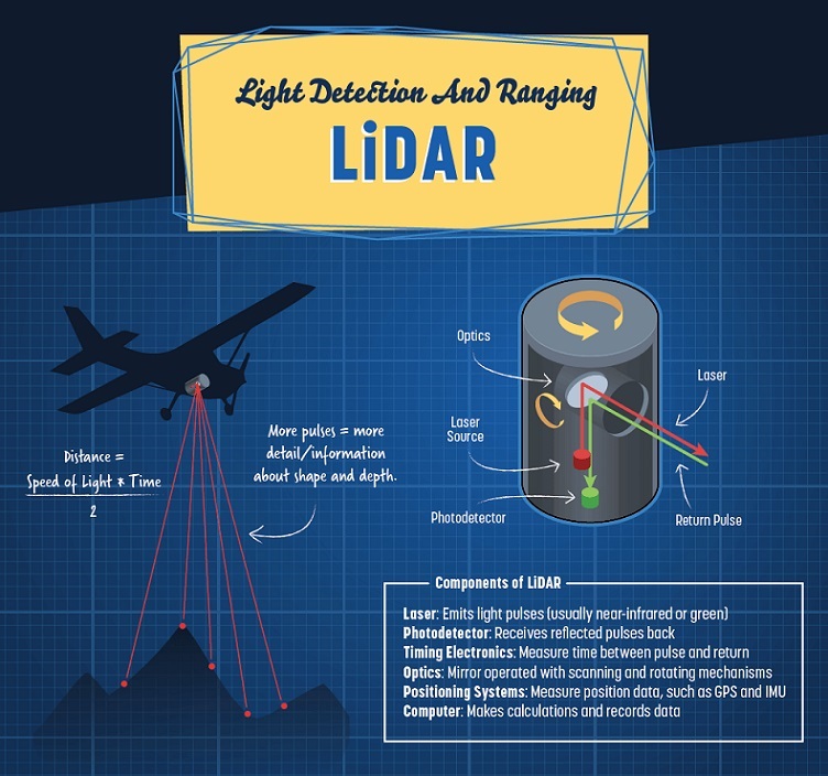
Light detection and ranging (lidar) is a remote detection technology that relies on light in the form of laser pulses to determine variable distances by measuring the time it takes the pulses to reflect off objects or surfaces and return to its receiver.
These systems use green or near-infrared light to scan an area downwards or side to side from an application and flashes up to 400,000 laser pulses per second. Lidar components include a laser and optics working as a mirror with scanning and rotating mechanisms to reflect the laser from its source. A photodetector serves as the receiver for the return pulse, and timing electronics are included to measure the time between the pulse and return. A positioning system measures the altitude and position of the application from the global positioning system and inertial measurement unit.
Topographic lidar uses an infrared laser to map ground characteristics, enabling ecologists to analyze rainforest landforms and conservationists to research forest vegetation. Bathymetric lidar uses two lasers to measure the shallow depths in bodies of water. Oceanographers use this system to study the physical elements of oceans and detect possible shipwrecks.
[Find suppliers and manufacturers of lidar systems on GlobalSpec]
Lidar technology is utilized every day in mobile devices, self-driving cars, drones and space exploration applications.
